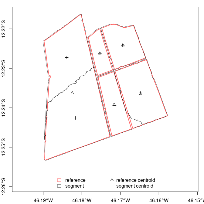
The segmetric is an open source package that provides a
set of metrics for analyzing and evaluating geospatial segmentations. It
implements 28 supervised metrics used in literature for spatial
segmentation assessment (see References below).
Installation
# install via CRAN
install.packages("segmetric")
Development version
To install the development version of segmetric, run the
following commands:
This research was supported by the European Research Council (ERC)
under the European Union’s Horizon 2020 research and innovation program
(Grant agreement No 677140 MIDLAND).
References
Carleer, A.P., Debeir, O., Wolff, E., 2005. Assessment of very high
spatial resolution satellite image segmentations. Photogramm. Eng.
Remote. Sens. 71, 1285-1294. http://dx.doi.org/10.14358/PERS.71.11.1285.
Clinton, N., Holt, A., Scarborough, J., Yan, L., Gong, P., 2010.
Accuracy assessment measures for object-based image segmentation
goodness. Photogramm. Eng. Remote. Sens. 76, pp. 289-299.
Dice, L.R., 1945. Measures of the amount of ecologic association
between species. Ecology, 26(3), pp.297-302.
Feitosa, R.Q., Ferreira, R.S., Almeida, C.M., Camargo, F.F., Costa,
G.A.O.P., 2010. Similarity metrics for genetic adaptation of
segmentation parameters. In: 3rd International Conference on Geographic
Object-Based Image Analysis (GEOBIA 2010). The International Archives of
the Photogrammetry, Remote Sensing and Spatial Information Sciences,
Ghent.
Jaccard, P., 1912. The distribution of the flora in the alpine
zone.
Janssen, L.L.F., Molenaar, M., 1995. Terrain objects, their dynamics
and their monitoring by the integration of GIS and remote sensing. IEEE
Trans. Geosci. Remote Sens. 33, pp. 749-758. http://dx.doi.org/10.1109/36.387590.
Levine, M.D., Nazif, A.M., 1982. An experimental rule based system
for testing low level segmentation strategies. In: Preston, K., Uhr, L.
(Eds.), Multicomputers and Image Processing: Algorithms and Programs.
Academic Press, New York, pp. 149-160.
Lucieer, A., Stein, A., 2002. Existential uncertainty of spatial
objects segmented from satellite sensor imagery. Geosci. Remote. Sens.
IEEE Trans. 40, pp. 2518-2521. http://dx.doi.org/10.1109/TGRS.2002.805072.
Moller, M., Lymburner, L., Volk, M., 2007. The comparison index: a
tool for assessing the accuracy of image segmentation. Int. J. Appl.
Earth Obs. Geoinf. 9, pp. 311-321. http://dx.doi.org/10.1016/j.jag.2006.10.002.
Persello, C., Bruzzone, L., 2010. A novel protocol for accuracy
assessment in classification of very high resolution images. IEEE Trans.
Geosci. Remote Sens. 48, pp. 1232-1244. http://dx.doi.org/10.1109/TGRS.2009.2029570.
Rezatofighi, H., Tsoi, N., Gwak, J., Sadeghian, A., Reid, I.,
Savarese, S.,
In: Proceedings of the IEEE/CVF Conference on Computer Vision and
Pattern Recognition (CVPR), pp. 658-666.
Van Coillie, F.M.B., Verbeke, L.P.C., De Wulf, R.R., 2008.
Semi-automated forest stand delineation using wavelet based segmentation
of very high resolution optical imagery. In: Object-Based Image
Analysis: Spatial Concepts for Knowledge-Driven Remote Sensing
Applications, pp. 237-256. http://dx.doi.org/10.1007/978-3-540-77058-9_13.
Van Rijsbergen, C.J., 1979. Information Retrieval.
Butterworth-Heinemann, London.
Weidner, U., 2008. Contribution to the assessment of segmentation
quality for remote sensing applications. Int. Arch. Photogramm. Remote
Sens. Spat. Inf. Sci. 37, pp. 479-484.
Yang, J., Li, P., He, Y., 2014. A multi-band approach to
unsupervised scale parameter selection for multi-scale image
segmentation. ISPRS J. Photogramm. Remote Sens. 94, pp. 13-24. http://dx.doi.org/10.1016/j.isprsjprs.2014.04.008.
Yang, J., He, Y., Caspersen, J. P., Jones, T. A., 2017. Delineating
Individual Tree Crowns in an Uneven-Aged, Mixed Broadleaf Forest Using
Multispectral Watershed Segmentation and Multiscale Fitting. IEEE J.
Sel. Top. Appl. Earth Obs. Remote Sens., 10(4), pp. 1390-1401. http://dx.doi.org/10.1109/JSTARS.2016.2638822.
Zhan, Q., Molenaar, M., Tempfli, K., Shi, W., 2005. Quality
assessment for geo‐spatial objects derived from remotely sensed data.
International Journal of Remote Sensing, 26(14), pp.2953-2974. http://dx.doi.org/10.1080/01431160500057764.
Zhang, X., Feng, X., Xiao, P., He, G., Zhu, L., 2015a. Segmentation
quality evaluation using region-based precision and recall measures for
remote sensing images. ISPRS J. Photogramm. Remote Sens. 102, pp. 73-84.
http://dx.doi.org/10.1016/j.isprsjprs.2015.01.009.
Need a high-speed mirror for your open-source project?
Contact our mirror admin team at info@clientvps.com.